Saigoneer is proud to be the media sponsor of the TP. Hồ Chí Minh: MEGA City photo book which was formally released on February 19. The book, edited by Michael Waibel and Henning Hilbert, was produced with the support of the Goethe Institut, and funding from Audi. It is split into 8 chapters, each covering a major theme related to HCMC's rapid urban development. Over the course of the next few weeks, we’ll be giving you an overview of the book's fantastic photos. Today we’ll take a closer look at the second chapter: Change Over Time.
The book is available at HCMC Artbook book shops. To order a copy directly, please contact info@saigoneer.com.
This article is part of a series. One can find the previous articles here.
During recent years, Ho Chi Minh City has witnessed many substantial transformations of its physical fabric. Three major changes can be identified.
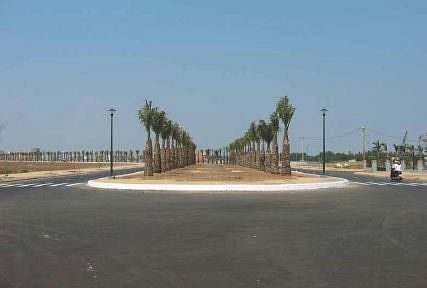
New urban area Phu My Hung (2004). Photos by Michael Waibel.
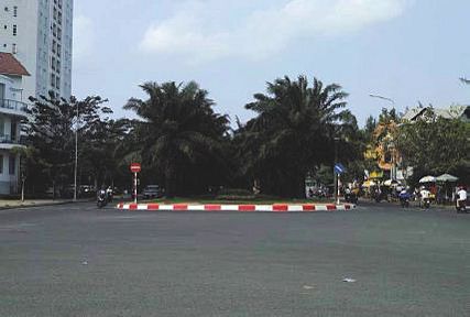
New urban area Phu My Hung (2013). Photo by Michael Waibel.
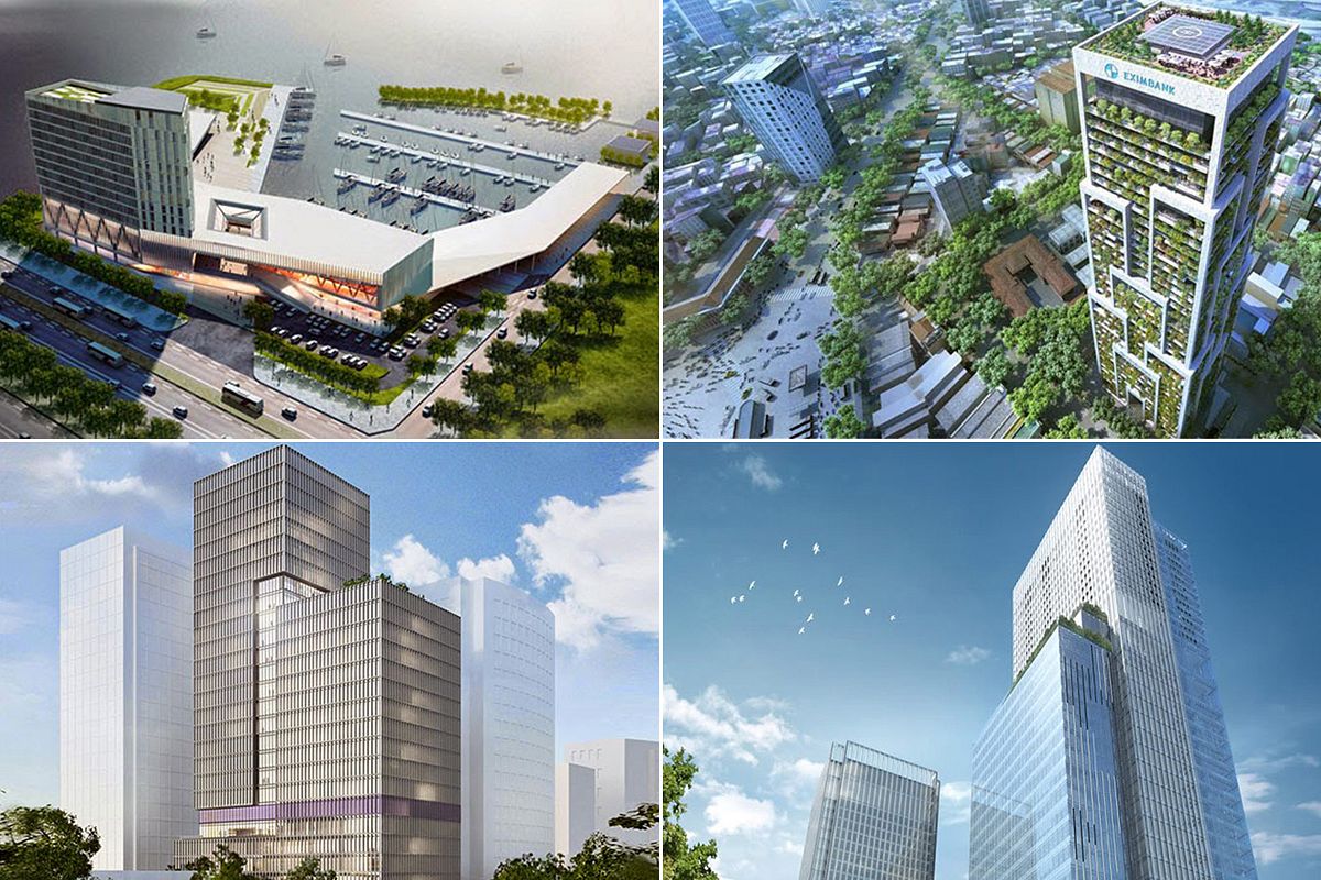
The first is the dynamic development of a modern skyline with an impressive concentration of new high-rise buildings erected by national and international companies in the city centre. Among them, the most famous would certainly be the Bitexo Financial Tower with its notable shape and helicopter platform with the Vietnamese flag.
Other renowned buildings include the blue-glass steel construction of the Vincom Center with its sail-shaped flourishes atop each of its twin towers, the massive Times Square Building or the AB Tower with Ho Chi Minh City’s most famous night club, Chill, on its roof terrace.
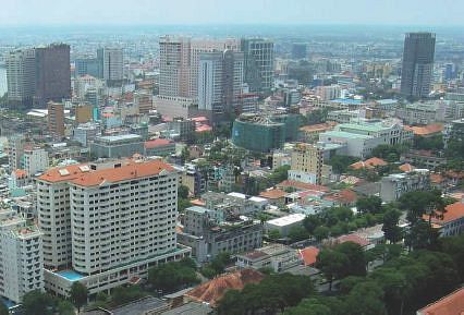
View from the Saigon Trade Centre (2003). Photo by Michael Waibel.
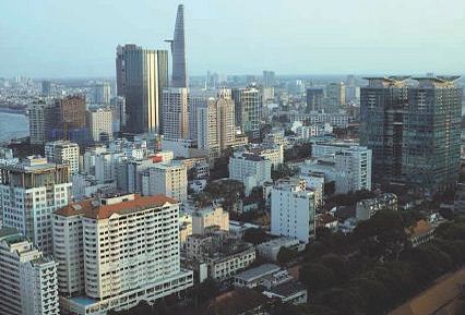
View from the Saigon Trade Centre (2013). Photo by Michael Waibel.
However, some people complain that the proliferation of high-rise buildings in the city centre is coinciding with the demolition of French colonial buildings, causing Ho Chi Minh City to lose its architectural heritage in the course of modernization.
A second striking feature of the recent urban development is the massive urban spatial expansion, which has already expanded across administrative borders, particularly in the western and eastern parts of the city. The most prominent example of urban spatial expansion is certainly Saigon South, a new urban area south of District 4 and District 8.
Over 500,000 people are expected to live within this mixed-used urban quarter in the future. Already in the past decade, the Phu My Hung new city centre in particular, developed by a joint venture company from Taiwan, developed remarkably. The photos in this chapter illustrate the densification of the built environment as well as the rapid growth of vegetation.
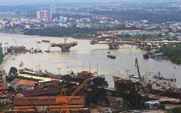
Ba Son port, Thu Thiem bridge under construction (2007). Photo by Nguyen Chinh Luong.
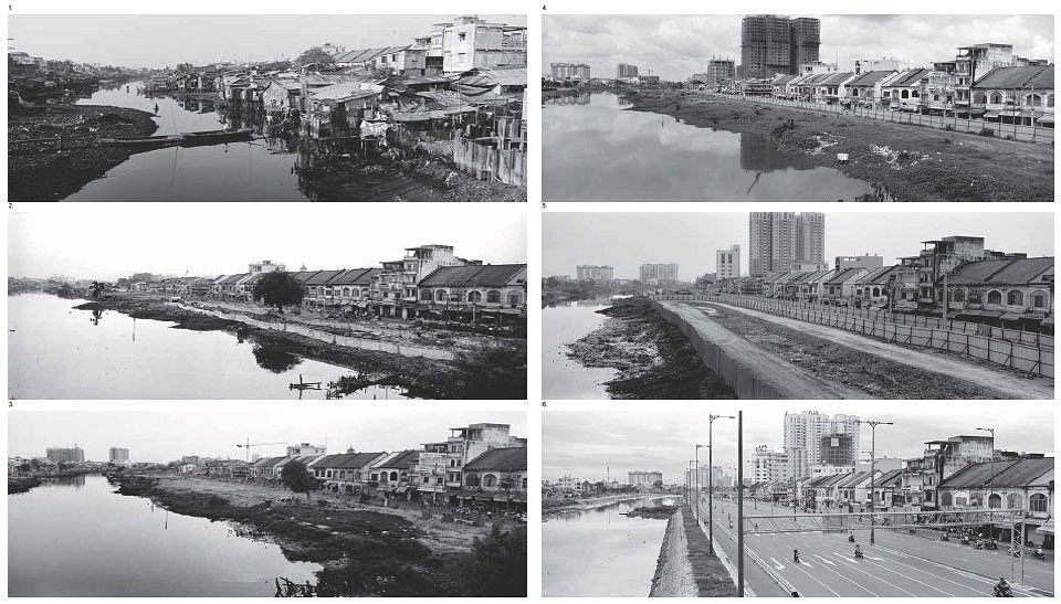
A third feature is the implementation of major infrastructure projects such as the erection of new highways, bridges and the development of a new central business district on Thu Thiem peninsula. The erection of the Vo Van Kiet Highway, supported by Japanese donor organisations, is another prominent example. This often was accompanied by the demolition of marginal settlement areas along the canals.
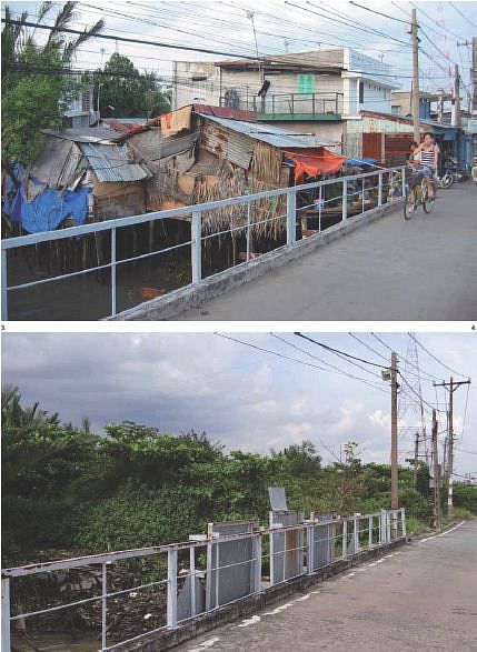
View from Luong Dinh Cua Street in Thu Thiem towards District 1 (2004 - 2013). Photo by Michael Waibel.
However, it cannot be denied that the local population suffered from eviction and only meager compensation in some cases.
All in all, it can be said that the urban development projects significantly enhanced the quality of life for the overwhelming majority of the mega city’s inhabitants. They added new green, leisure and commercial spaces, high-quality residential units and new traffic infrastructures, which eased prevalent congestion.
This article is part of a series. One can find the previous articles here.
The book is available at HCMC Artbook book shops. To order a copy directly, please contact info@saigoneer.com.
[Top images (2001 - 2011) taken by Laurent Weyl]

